
(Blog Written by Donald Sutherland)
August 1-7, 2012 Thoughts:
The story of this period will likely continue to be a persistence of high heat and lack of rainfall in the drought-stricken Central Plains. Although the East Coast and Great Lakes regions are likely to be warmer than normal, excessive heat does not appear likely to predominate during the opening week of August.
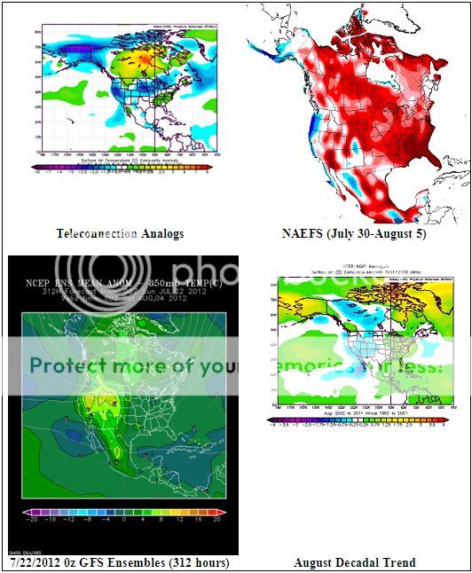
The charts shown below are as follows:
Top Left: Composite temperature anomalies for ENSO Region 3.4 anomalies of +0.20°C to +0.80°C, a PNA of -1.00 to 0.00, and an AO of +0.25 to +1.00 for North America.
Top Right: NAEFS forecast for the July 30-August 5, 2012 timeframe
Bottom Left: 7/22/0z GFS ensemble mean 850 mb anomalies at 312 hours (August 4, 2012)
Bottom Right: Observed decadal temperature trend for August
For the August 1-7 timeframe, there appears to be little prospect of significant rains over most or all of the drought-affected portion of the CONUS.
Taking into consideration all of the date, my thoughts are as follows:
– Warmer than normal across most or all of Canada
– Near normal to somewhat above normal in the Great Lakes Region and the Mid-Atlantic/Northeast regions.
– Much warmer than normal in the Central Plains
– Warmer than normal across the rest of the U.S.