
Good Evening Everyone,
Tonight, I like to share with you a quick view of past weather events in October. One of the really nice websites out there is the National Climate Data Center. They offer a ton of climate weather data. In this blog, I like to highlight several key images for the month of October.
The first image shows what happen globally with regard to weather hazards. If you click on the image below, you will able to see it much larger.
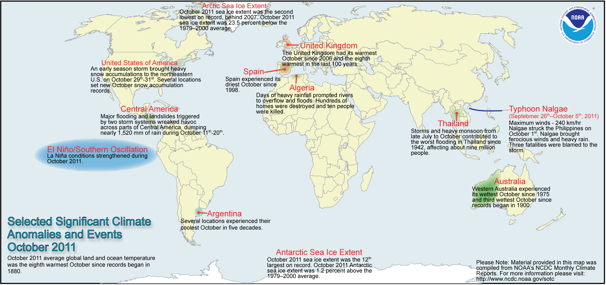
Next, let’s take a look at the Significant Events for the month of October. If you click on the image below, you will able to view the full report for this month. Again, there is a lot of data they review for this month.

One of the more interesting images I always like to take a look at is the 500mb Height and Anomaly map. When you look at the 500mb map, you can get a sense where ridges and trough setup. The shades of red indicate ridging, while the shades of blue indicate trough.
Let’s compare October of this year to last year. Click on the image to see October of 2010.

Now, let’s do something really cool and you can do this as well. Take a look from last year as we went from October to November. Notice how the upper air was setting up. Click on the image to see November of last year. Notice how impressive the ridging was setting up over Alaska and over Eastern Canada and Greenland. Notice how much blocking was setting up over these locations. This would eventually lead to some significant cold over the Central and Eastern US as we went into December. Plus, a more favorable pattern for snow for the same locations.

As you can see, there is so much data you can analyze.. To access this data and more, head over to National Climate Data Center.