
Hi Everyone,
Check out the latest US Hazards Outlook from the Climate Prediction Center below.
US HAZARDS OUTLOOK
NWS Weather Prediction Center and Climate Prediction Center
College Park, MD
300 PM EDT Thursday, April 11th, 2024
| Day 3 – 7 Outlook | Day 8 – 14 Outlook |
 |
|
US Day 3 – 7 Hazards Outlook
Issued by the Weather Prediction Center (WPC)
Valid Sunday, April 14th through Thursday, April 18th
...Deepening Plains surface low likely to bring severe and heavy rainfall threats ahead of it and strong winds and notable snow behind…
…Overview…
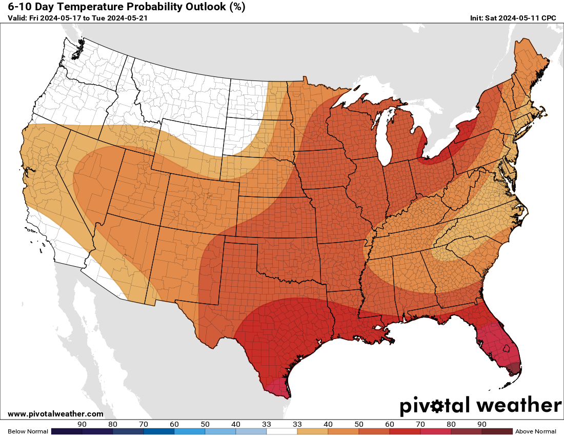
A closed low over Nevada/California to start the period Monday will progress eastward eventually supporting a deepening low pressure system over the Plains by Tuesday. Various hazards are likely with this storm system, including severe weather and bands of heavy rainfall on the warm side along with a broad area of gusty winds. Behind this storm, another upper trough digging down from British Columbia into the Northwest U.S. early next week should ultimately evolve into a broader positively tilted mean trough from south-central Canada through the West. Expect this trough to bring colder temperatures and multiple days of snow potential especially to the northern half of the Rockies/High Plains. Meanwhile upper ridging over the Plains on Sunday will shift eastward and settle near the East Coast Tuesday-Thursday, leading to a corresponding shift for above normal temperatures.
Click here for full details
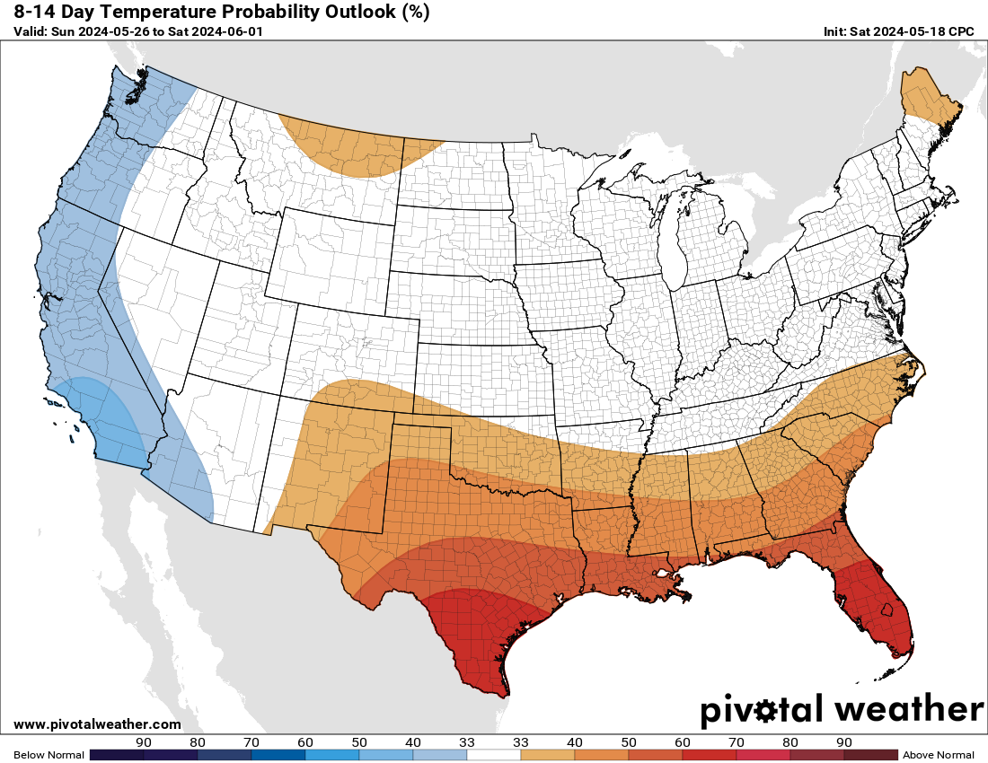
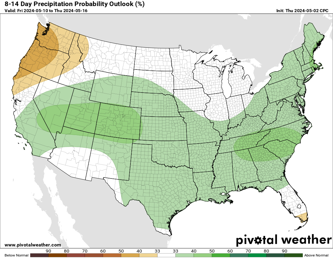
US Weather Hazards
Issued by the Climate Prediction Center
8 to 14 Day Outlook Summary
Valid Friday, April 19th through Thursday, April 25th
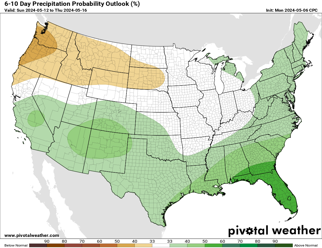
Synopsis: Mid-level low pressure is forecast across the north-central contiguous U.S. (CONUS) early in week-2. While chances for frontally focused precipitation are still elevated over portions of the east-central CONUS at the outset of the period, confidence decreases thereafter as models differ in the amplitude of the mid-level low and resultant flow pattern across the East. A more southwesterly flow pattern would enhance precipitation chances across much of the East, while a more amplified mid-level low and resultant increased northerly flow may limit the greatest precipitation potential to the Gulf Coast. As surface high pressure builds southward early in week-2, elevated wind speeds are possible along its periphery, including over the Upper Mississippi Valley, Great Lakes, Southwest, and Central and Southern Rockies and High Plains, with upslope snow remaining possible across the Central Rockies.
| Experimental Probabilistic Outlooks |
||
 |
 |
 |
| Temperature Hazards | Precipitation Hazards | Wind Hazards |
 |
||
| Snow Hazards | ||
Weather Hazards
For the full discussion, click here |
||
| 6 to 10 Day Maps | |
 |
 |
| 6 to 10 Day Analog Year Maps | ||
| 500mb Map | Temperatures | Precipitation |
 |
 |
 |
|
8 to 14 Day Maps |
|
 |
 |
| 8 to 14 Day Analog Year Maps | ||
| 500mb | Temperature | Precipitation |
 |
 |
 |
*********************************************************************************************************************
Climate Prediction Center
Background
Vision
- An informed society preparing for and responding to climate variations and their impacts
Mission
- CPC delivers real-time products and information that predict and describe climate variations on timescales from weeks to years thereby promoting effective management of climate risk and a climate-resilient society.
Expert Assessments
- Climate Prediction Center (CPC) meteorologists and oceanographers review climate and weather observations and data along with model results; assess their meaning, significance, and current status; and likely future climate impacts. Their findings are issued as assessments, advisories, special outlook discussions, and bulletins.
U.S Hazards Outlook
- From Monday-Friday, the CPC issues an outlook of weather- and climate-related hazards to the United States for the next three to fourteen days.