
Hi Everyone,
Just got done updating this blog. So far based on analyzing these telleconnection indices, the 5 day period may be our best shot for snowfall and cold, but once we get into the 6 to 10 and 11 to 15 time frame, which brings us to January 10th, the pattern from the very cold could transition into a warmer than average. It appears the signals for wintry weather will be going against that idea. So, thats a brief overview of the forecast right now. Typically La Nina seasons, you just don’t get the big winter storms. This cold spell we’re seeing may end up with not much snowfall. So far, all the of the model runs haven’t quite showed a consistent threat for snowfall. So, thats the latest at this hour. I’ll update this blog Thursday afternoon.
***************************************************************************************************************************************
Previous Announcement: I’m introducing a new blog that will be focused on identifying future winter weather patterns (i.e., winter storms) for Eastern US.
I wanted share with a sneak peak. Right now, it looks like I’ll be updating this blog on Mondays, since its more a longer term pattern outlook. Some other forecast products will get updated more frequently, but this one will be issued like once a week.
One of the things I’ve really gotten interested in using is telleconnection forecasting. Basically, it consists of indices that involve whether ridging will take place over the Western US, arctic air available for the Eastern US to blocking over Greenland. Its these factors that hold the key on whether a weather pattern is favorable for winter weather.
One of the excellent long range forecasters I’ve been following for a while is Dave Toleris. If you want to learn how all this works, I highly recommend anyone to check out his thoughts on long range weather forecasting. The past year or so, he updated his website. He’s developed a section on his website on Snowstorms. Its what he developed that got me thinking. The table he put together is called North American Telleconnection Pattern Index or N.A.T.P.I. Its a great way to see if a weather pattern will be favorable for winter weather.
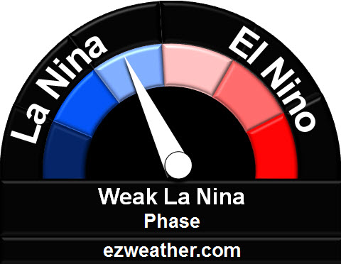
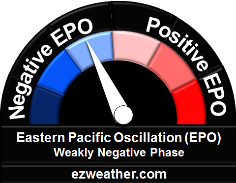
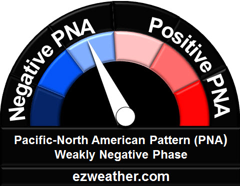
So, let’s get started. Each table will provide a speedometer like scale showing you the state of El Nino or La Nina, Pacific and Atlantic state, and MJO. I’ve made sure to spell what these are and further background in hyperlinks. I’ll provide a summary statement on whether a forecast period is favorable for winter weather.
One final point, as a forecaster, you need to understand how the pattern will evolve and not rush to judgement based on a certain model run. Its very important to see how things are trending versus a model run that shows a winter storm, when the weather pattern doesn’t support that model solution.
So, thats a brief overview. If you have any questions, please provide a comment and I’ll be happy to answer your question.
| Telleconnection Indice Dashboard Forecast Wednesday, December 27th through Sunday, December 31st (1 to 5 Day Outlook) |
||
| Pacific Region |
||
 |
 |
 |
| Basics – Click here Australian Site click here |
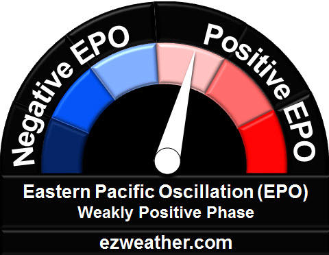
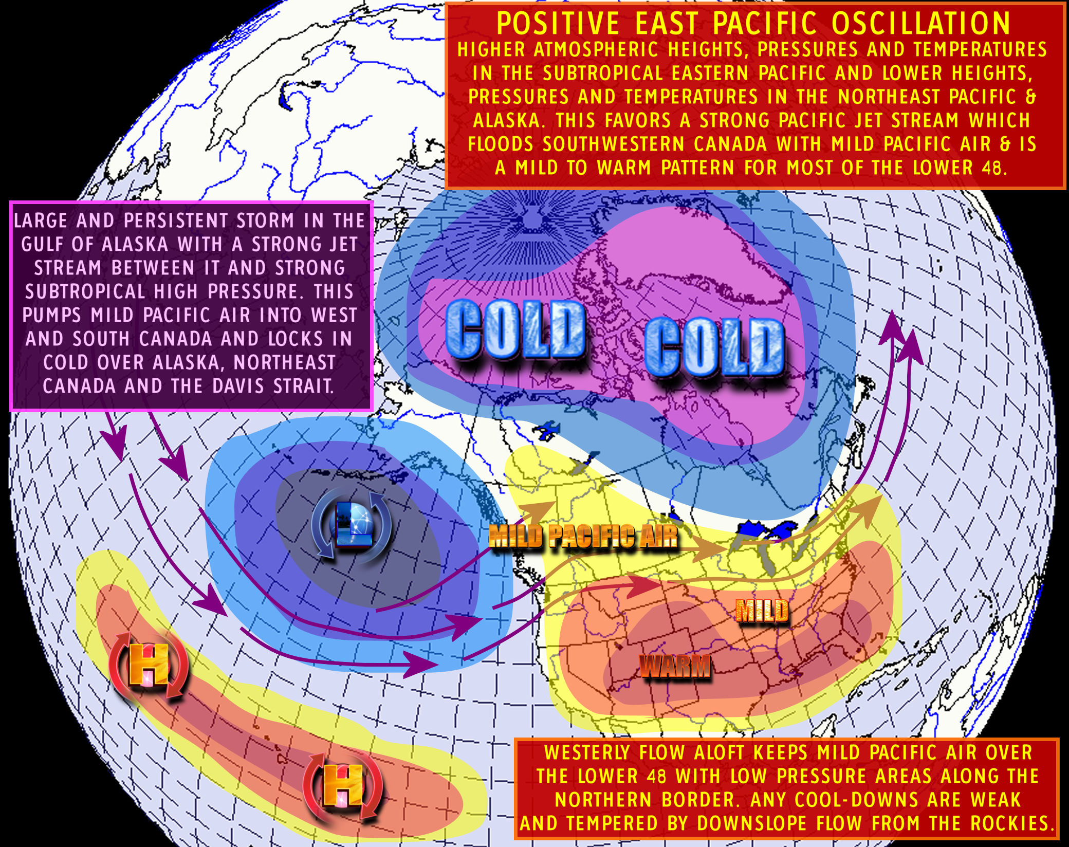
Basics – Negative EPO, Positive EPO | Basics – Click here |
| Atlantic Region | ||
 |
 |
|
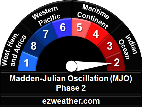
| MJO Composites – Click here (Check out Kyle MacRitchie Website) |
Basics – Click here | Basics – Click here |
| Projected Upper Air Pattern | ||
 |
 |
 |
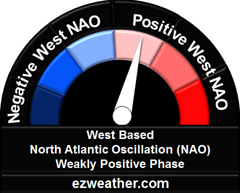
| Negative AO | Negative West Based NAO | Negative PNA |
 |
 |
|
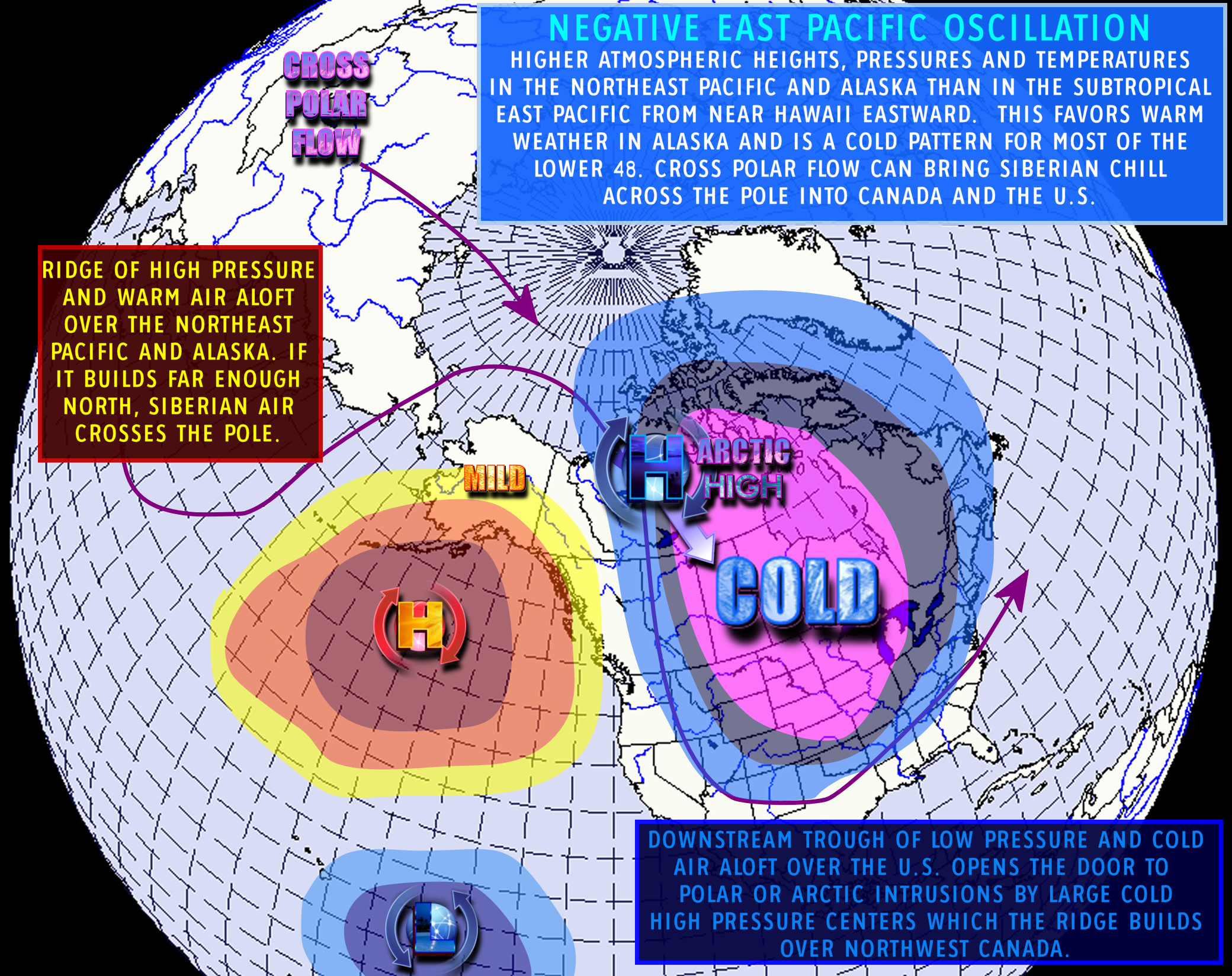
| Negative EPO | MJO Phase 8 | |
|
The AO, NAO, PNA upper air composites are provided by the State Climate Office of North Carolina. The upper air composites for EPO are provided by SnowBrains.
|
||
Summary
|
||
| Telleconnection Indice Dashboard Forecast Monday, January 1st through Wednesday, January 5th (6 to 10 Outlook) |
|||
| Pacific Region |
|||
|
|
 |
|
| Basics – Click here Australian Site click here |
Basics – Negative EPO, Positive EPO | Basics – Click here | |
| Atlantic Region | |||
 |
 |
 |
|
| MJO Composites – Click here (Check out Kyle MacRitchie Website) |
Basics – Click here | Basics – Click here | |
| Projected Upper Air Pattern |
|||
 |
 |
 |
|
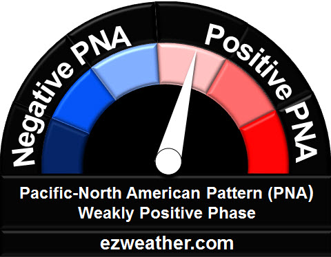
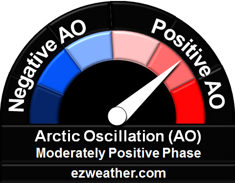
| Positive AO | Positive West Based NAO | Positive PNA | |
|
|||
| Negative EPO | |||
|
The AO, NAO, PNA upper air composites are provided by the State Climate Office of North Carolina. The upper air composites for EPO are provided by SnowBrains.
|
|||
Summary
|
|||
| Telleconnection Indice Dashboard Forecast Thursday, January 6th through Wednesday, January 10th (10 to 15 Day Outlook) |
|||
| Pacific Region |
|||
|
 |
|
|
| Basics – Click here Australian Site click here |
Basics – Negative EPO, Positive EPO | Basics – Click here | |
| Atlantic Region | |||
 |
 |
|
|
| MJO Composites – Click here (Check out Kyle MacRitchie Website) |
Basics – Click here | Basics – Click here | |
| Projected Upper Air Pattern | |||
|
|
|
|
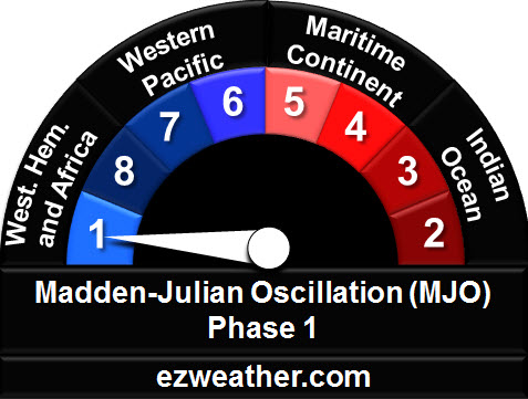
| Positive AO | Positive West Based NAO | Negative PNA | |
 |
 |
||
| Positive EPO | MJO Phase 2 | ||
|
The AO, NAO, PNA upper air composites are provided by the State Climate Office of North Carolina. The upper air composites for EPO are provided by SnowBrains.
|
|||
Summary
|
|||